Last night posed significant challenges to the western regions, as multiple supercell thunderstorms unleashed damaging tornadoes and large hail. Monitoring the aftermath, we’ll stay vigilant for damage and injury reports overnight into Friday morning.
While the supercell storms near Abilene have tapered off, those to the north and west of Wichita Falls have regained strength, albeit moving slowly northeastward. Meanwhile, a potent storm in San Saba County, Central Texas, is tracking east/southeast and shouldn’t pose a threat to North Texas overnight.
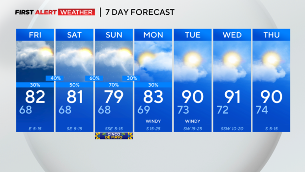
As we progress into the overnight hours, our storm risk diminishes. While a few isolated storms have popped up in North Texas post 8:30 p.m., none have reached severe levels. However, scattered storms may persist into Friday morning, especially south of I-20, potentially exacerbating flooding concerns. This risk extends beyond Friday, lingering through the weekend.
Although the flood watch has expired, the prospect of more widespread rain and storm activity on Saturday into Sunday raises the possibility of another watch being issued over the weekend. It’s imperative to stay tuned to updates and heed any advisories to ensure safety amid these weather conditions.
